Boston’s Key Transit Options Explained

Boston offers one of the most approachable transit networks in the United States, centered around the MBTA’s subway—known locally as the “T”—along with commuter rail lines and an extensive bus system. For most travelers, the T is the backbone of getting around, linking major neighborhoods, universities, shopping districts, and historic sights across Boston and neighboring Cambridge. The commuter rail serves broader Massachusetts, reaching further out to scenic coastal and suburban towns that are perfect for scenic day trips.
What makes Boston’s network especially user-friendly is the CharlieCard, a reusable tap card that I quickly learned was essential for smooth travel. Instead of fumbling for cash or buying individual tickets at every station, I just kept my CharlieCard loaded, saving both time and about $0.50 per ride compared to paper tickets. The CharlieCard works on the subway, local buses, and even connects easily when switching between most transit modes, so once you have one, you’re set for most urban trips.
The MBTA (“Massachusetts Bay Transportation Authority”) covers the city and much of the region, serving both tourists on classic sightseeing runs and locals heading to work or class. With central lines radiating from Downtown Crossing and Park Street, it’s surprisingly simple to reach nearly any point of interest—including the majority of Boston’s top attractions. If you’re planning to check out some popular spots, I recommend looking over our guide to Boston sightseeing spots accessible by public transit to make the most of your time here.
Boston T Lines and How They Connect
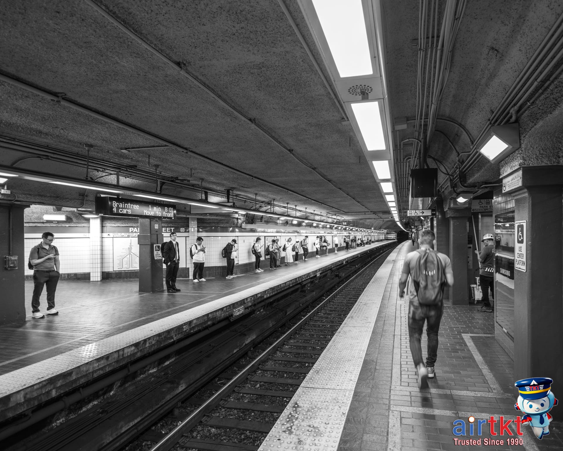
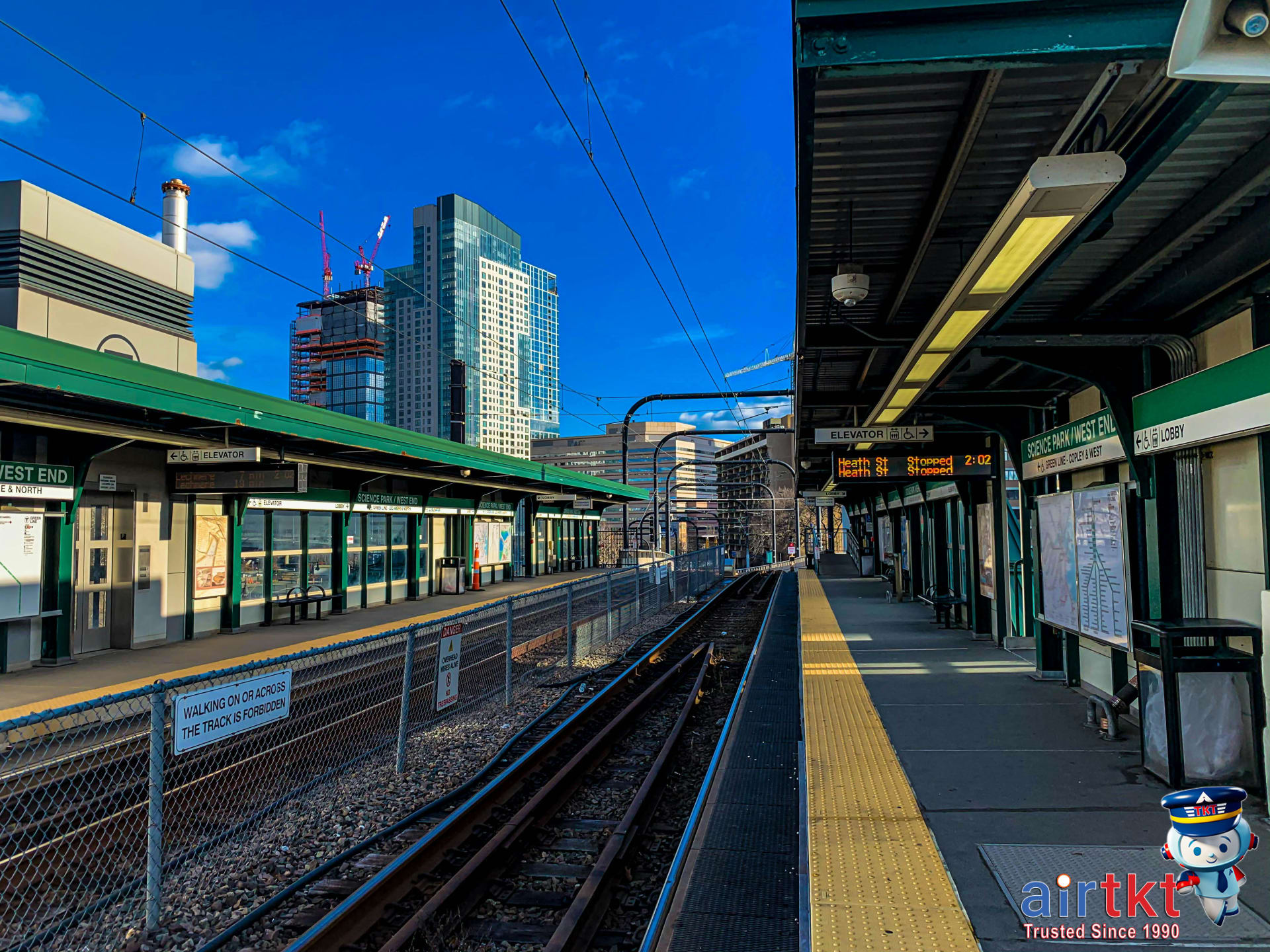
The T subway is the backbone of Boston’s public transit system, connecting neighborhoods and major attractions with a web of four color-coded lines. The Red Line stretches from Cambridge through central Boston and into the southern suburbs, serving stops like Harvard Square, South Station, and Kendall/MIT. The Green Line—notorious for its winding routes and frequent stops—branches into several sections and is your gateway to places like Fenway Park, Kenmore, and Boston University. The Orange Line runs north to south, linking Oak Grove to Forest Hills, with useful stops at North Station and Back Bay. Lastly, the Blue Line connects downtown Boston with Logan Airport and the city’s northern waterfront, making it handy for arrivals and departures.
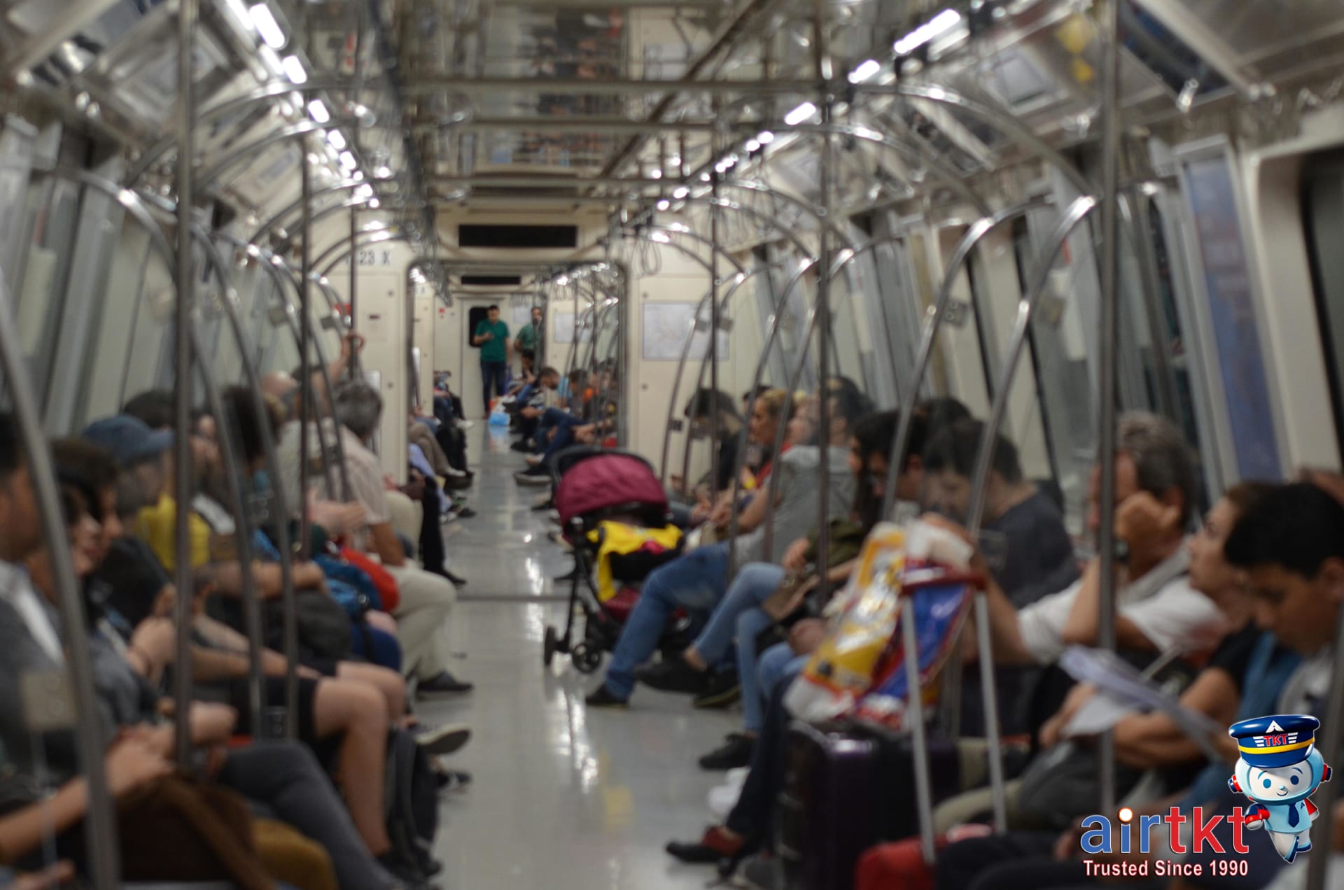
Most T trains operate from early morning until just after midnight. Trains can be frequent—every few minutes during rush hour—but outside of peak times, you may wait a bit longer, so keeping an eye on train arrival boards is a smart move. I learned the hard way that riding the T at rush hour means squeezing into crowded cars and sometimes waiting for the next train when platforms are packed, so I now schedule activities to avoid those crunch times whenever possible.
Popular T Stations and Transfers
Key transfer points include Park Street (where the Red and Green lines cross), Downtown Crossing (Red and Orange), and Government Center (Green and Blue). These central stations make it simple to switch lines or reach central tourist destinations. South Station is especially important for connections to trains and buses traveling beyond Boston. Navigating the transfer system is fairly intuitive, but if you’re visiting for the first time, I recommend reviewing a T map or using a digital transit app.
The experience of riding the T shifts dramatically between peak and off-peak periods. Morning and evening commutes can be intense, with lots of people and limited personal space, while midday and late evenings are usually much more relaxed. For more details on navigating specific neighborhoods by public transit, check out our Boston neighborhood transit guide.
How to Use the CharlieCard and Where to Buy It
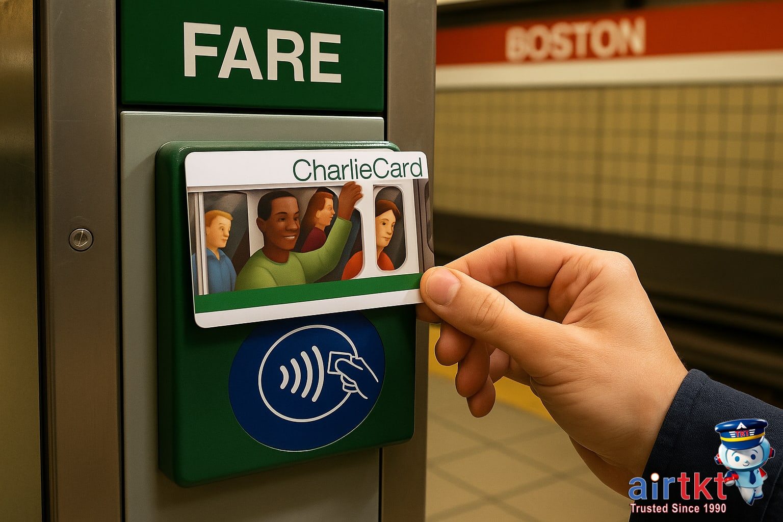
The CharlieCard is a reusable, contactless card used for paying fares on Boston’s MBTA subway and bus system. Riders prefer it over paper tickets because it’s easy to reload, fits neatly in your wallet, and offers a small but meaningful fare discount compared to single-use tickets. If you’re planning multiple MBTA rides, having a CharlieCard handy will simplify every trip.
Buying and Reloading the Card
You can get your first CharlieCard at staffed subway stations, MBTA customer service centers, and select retail outlets around Boston. In my experience, grabbing a card at downtown station desks was the quickest option—no lines, and the staff answered all my questions. Once you have your card, it’s easy to reload funds at any station vending machine, which accepts cash or credit cards. Just tap your card, follow the onscreen prompts, and load any amount you want.
Where to Purchase a CharlieCard
Beyond major subway stations, many convenience stores, grocery stores, and pharmacies throughout Boston sell or reload CharlieCards. Look for the MBTA logo at the counter. Some travelers wonder about buying online, but currently, online sales cater mainly to monthly pass holders and need extra advance planning. For most visitors, using vending machines or local retailers is faster and more flexible.
How to Use the Card on MBTA
After loading your card, just tap it at fare gates or bus fareboxes—the system automatically deducts your fare. Using a CharlieCard is not only speedier than paper tickets, but it also helps you save a bit each ride. If you want a full breakdown of fare types, discounts, and MBTA payment policies, check out the MBTA fare policies and discounts page for more details.
Essential Advice for Boston Commuter Rail
The MBTA Commuter Rail is your link between downtown Boston and dozens of cities and towns across Massachusetts and beyond. Trains extend far past popular areas like Cambridge and Somerville, reaching destinations such as Salem, Concord, Newburyport, and even Worcester. If you’re planning a day trip, this network offers convenient and scenic options out of the city—just keep in mind the service is less frequent than the T subway.
Buying tickets is straightforward, but it pays to do it right. You can purchase your ticket from station vending machines, onboard (often at a higher price), or via the MBTA mTicket app. In my experience, using the app on a busy weekend day saved me from a long line and let me board without stress. Always be sure to activate and validate digital tickets before boarding; train conductors check tickets, and fines apply for riding without a valid fare.
Plan Carefully for Punctual Trips
The commuter rail doesn’t run as often as Boston’s subway lines—especially outside of rush hour or on weekends—so checking the schedule before you travel is essential. Missing a train might mean a wait of an hour or more. During weekday mornings and late afternoons, expect trains to be crowded with commuters. If you want a seat, arrive early and line up on the platform a few minutes before boarding starts. Off-peak times are more relaxed and usually offer plenty of space.
Seats are generally comfortable, but on packed rush-hour trains, they fill up fast. If you’re heading out for a leisure trip, traveling after 9:30am or midday gives you a more comfortable experience. For those considering regional adventures, I’ve found that the commuter rail is a practical way to reach top sites like Salem or Concord—check out our Boston day trip guide by commuter rail for more ideas.
Navigating MBTA Transit Maps and Connections
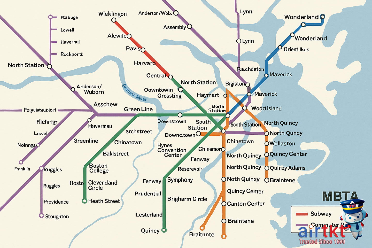
Figuring out how to get around Boston using the MBTA can seem overwhelming at first, but understanding the transit map goes a long way in making your trip easier. MBTA maps are designed to help you visualize the major subway lines (the “T”), the commuter rail network, and major bus routes, each with distinct colors and symbols. When I needed to get from downtown Boston to a suburb, I relied on the MBTA system map to quickly spot my transfer from the Orange Line to the commuter rail at North Station, saving me time and stress.
Reading MBTA Subway and Rail Maps
The map highlights the four main subway lines—Red, Orange, Blue, and Green—as bold colored tracks, with transfer stations marked by large circles or interlocking icons. Commuter rail lines are thinner and extend further out, connecting city hubs to suburbs across Greater Boston. Understanding where these lines intersect helps you plan efficient routes, especially for longer or multi-modal journeys.
Identifying Transfers and Connections
Key transfer stations like Downtown Crossing, Park Street, and South Station let you switch between subway lines, or between subway and commuter rail. I’d double-check these points on the map before heading out, so I knew exactly where to switch without backtracking. Bus routes are shown with lines or shaded areas branching from major stations—great for last-mile connections if your destination isn’t right on the T.
Planners and Digital Tools
Paper maps are available at most MBTA stations, but digital maps offer added convenience—especially when service updates or detours occur. The official MBTA Transit app and several third-party apps let you view live maps, plan routes, and get real-time schedule info on your phone. If you want more on app options, check out this guide to Boston transit apps and technology.
Making Sense of Multi-Modal Journeys
Your fastest trip might combine subway, rail, and bus—so don’t just follow one colored line all the way. Estimate travel times by counting stops on the map (about 2–4 minutes per subway stop in central areas), and factor in transfer points. Using both the in-station maps and an app has helped me avoid missed connections and long waits more than once.
Managing Your CharlieCard Digitally
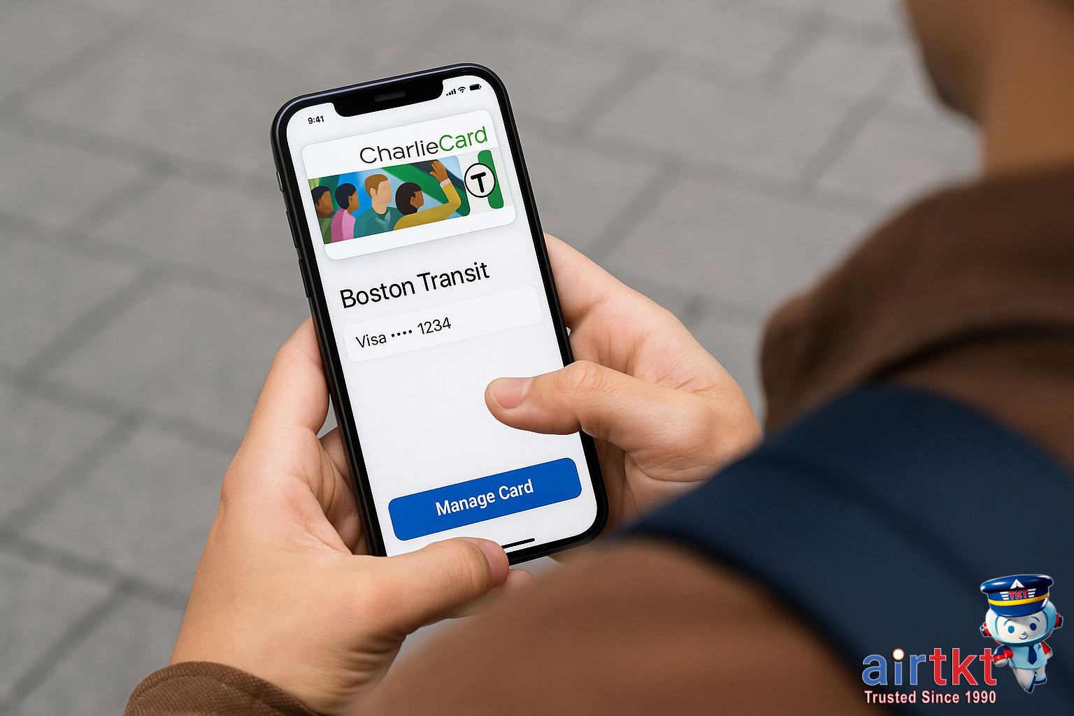
Gone are the days when you had to queue at a kiosk just to reload your CharlieCard or check your balance. The MBTA’s online portal and CharlieCard mobile app now make managing your transit card much easier, whether you’re a daily commuter or an occasional visitor to Boston. I’ve found managing my CharlieCard via smartphone has saved me from last-minute scrambles and given me peace of mind on days when I’m rushing to catch a train.
Setting Up Your Digital Account
Start by going to the MBTA’s CharlieCard management portal or downloading the official app. You’ll need to create an account using your email address, then link your physical CharlieCard by entering its serial number. Once your account is set up, you can securely reload funds online with a credit or debit card. The online platform lets you add value any time, so you’re never caught without fare.
Tracking Balances and Card Activity
Both the portal and app let you check your real-time balance, view recent ride transactions, and see if you’ve hit MBTA’s fare capping thresholds—a feature that automatically stops charging you after a certain number of rides, which is great for regular users. Travel history logs are especially handy for tracking monthly expenses or confirming if a fare deduction was made correctly.
Troubleshooting Lost or Damaged Cards
If you misplace your CharlieCard or it stops working, you can use the digital tools to report the issue. After logging in, follow the online steps to deactivate the lost card and request a replacement. Because your card is registered, your remaining balance can often be transferred to the new card, saving you from losing unused funds.
If you’d like a detailed walk-through, check out our step-by-step tutorial on MBTA mobile app features for more tips and screenshots.
Scenic Routes for Commuter Rail Adventures

Boston’s commuter rail network offers far more than just a way to get from point A to point B. Some routes double as unexpectedly scenic escapes, with stretches of track offering waterfront views, tranquil woodland passages, and classic glimpses of Boston’s skyline. If you’re looking to add memorable sights to your itinerary, it’s well worth planning your journey around these routes.
Best Lines For Picture-Perfect Views
For spectacular city and harbor scenery, the Newburyport/Rockport Line is a favorite of mine. Heading toward the North Shore, you’ll spot sailboats skimming along the coast, marshlands teeming with birds, and even lighthouses flashing in the distance. On the south side, the Plymouth Line offers stretches of tree-lined lakes and glimpses of small towns that feel a world away from downtown hustle. During one late-afternoon ride out to Newburyport, I was treated to golden hour light over the salt marshes—a simple commute that turned into a highlight of my week.
Leisure Rides and Day Trips
It’s not just about getting somewhere quickly—sometimes the journey is the destination. The Greenbush branch through Hingham and Cohasset is especially popular for leisurely weekend trips, passing through forests and hugging Massachusetts Bay in places. These rides are ideal for travelers who want to enjoy suburban charm en route to open-air activities or cozy local restaurants. You can also plan stops at small towns and explore a bit before catching the next train back.
Timing Your Ride For Comfort
Scenic rides are best enjoyed outside the hectic rush-hour periods. Mid-mornings and mid-afternoons typically offer quieter cars and unobstructed window seats, so you can take in the views at your own pace. I usually check the schedule and aim for a time when crowds thin out—especially if I’m hoping to snap some photos or just relax while the scenery unfolds. If you’re interested in combining your rail journey with local exploration, consider these Boston sightseeing tours accessible by commuter rail—many are timed for the most pleasant riding conditions.
Don’t forget to bring your camera or phone ready for shots. Some of the best commuter rail memories are simple moments: the Boston skyline glowing at sunset, rivers reflecting autumn foliage, or quiet neighborhoods sliding by your window.
Boston Transit Budget Table Breakdown
Boston is a city where your daily expenses can swing dramatically depending on how you travel, where you eat, and what kind of stay you prefer. I’ve put together a no-nonsense budget table to make it easier to compare options and get a realistic sense of typical costs. These numbers are designed to help you plan your trip—but remember, a little flexibility and research can lead to big savings, especially on transport and food.
| Accommodation | Food | Transport | Activities | |
|---|---|---|---|---|
| Budget | $55.00 | $22.00 | $7.00 | $12.00 |
| Mid-range | $140.00 | $45.00 | $13.00 | $32.00 |
| Luxury | $340.00 | $90.00 | $32.00 | $80.00 |
Stretching Your Boston Transit Dollars
The MBTA (“the T”) is one of Boston’s best assets for affordable travel. Regular MBTA fares work fine, but using a CharlieCard gives you discounted rides versus paying cash per trip at the station. The commuter rail is pricier, and most travelers only need it for outlying neighborhoods or day trips—so plan city sightseeing around subway zones if you want to save. Personally, I always factor in transport costs before booking hotels, since staying farther from central Boston can lead to increased daily fares even if the nightly room is cheaper. If you want more strategies for keeping your Boston costs low, check out this guide to affordable Boston travel tips.
Frequently Asked Questions About Boston Transit
- How do I pay subway and bus fares in Boston?
Boston’s MBTA subway and bus fares can be paid with a reusable CharlieCard or a CharlieTicket, which you load at station vending machines. You can also tap a contactless credit card or mobile wallet at the gates. I find the CharlieCard is the most flexible for regular rides throughout the city.
- Where can I get a CharlieCard for Boston transit?
CharlieCards are usually available free at major MBTA subway stations and select retail stores in Boston. Ask at station customer service booths or look for vending machines labeled with the CharlieCard logo. If you’re arriving by air, try the Logan Airport terminals before heading into the city center.
- What are Boston’s subway and commuter rail peak hours?
MBTA subway and commuter rail lines experience the most crowding during weekday mornings around 7:00–9:00 a.m. and evenings from 4:00–6:30 p.m. Trains are less crowded midday, at night, and on weekends. If you like extra space, traveling outside morning and afternoon rush is your best bet.
- What’s the best way to plan a Boston T route?
Use the official MBTA website or one of several free transit apps to map out your T route, check real-time schedules, and find transfer points. I often suggest these route planners to travelers, as using them clears up confusion before you’re in the subway looking for signs.
- Can I use a CharlieCard on the commuter rail?
You can’t use a regular CharlieCard for commuter rail fares, but you can purchase a CharlieTicket or use contactless payment at most Boston-area train stations. Conductors on board can also sell tickets. For frequent trips, consider buying a monthly commuter rail pass loaded onto your card.
- Are there any tips for buying tickets for the commuter rail?
Buying commuter rail tickets at station machines in advance usually saves time and a little money compared to buying onboard. Always keep your ticket handy, as conductors will check it during the ride. For help, MBTA staff at larger stations can answer questions or direct you to support resources.
In my experience, answering these questions up front clears up a lot of common misunderstandings for travelers navigating Boston’s transit system for the first time. If you’re looking for extra support before or during your trip, you can always reach out to the airtkt.com travel support desk or MBTA customer service.
Recap and Boston Transit Help
Boston’s public transit—especially the T subway and commuter rail—makes it easy to explore the city and surrounding areas without needing a car. The versatile CharlieCard streamlines your rides and offers discounts across most lines, so it’s worth picking up as soon as you arrive. For travelers trying to make the most of their time, the T covers most must-see neighborhoods, while the commuter rail quickly connects downtown with regional sites. Having used Boston’s transit multiple times myself, I can say it’s pretty intuitive once you get the basics down.
For updated and official route maps, schedules, and fares, check the Massachusetts Bay Transportation Authority’s (MBTA) website or grab a printed map at T stations. Mobile apps like Transit or the official MBTA app can help you navigate real-time arrivals, service changes, and even plan your entire route on your phone. If you run into any issues or need directions, you’ll usually find MBTA staff in major downtown stations ready to assist.
If you’re flying into Boston and looking for the smoothest connection between the airport, your hotel, and local attractions, planning your routes ahead of time is key. While this guide should get you started, don’t hesitate to reach out to other travelers, pick up a city map, or explore more resources online. Companies like airtkt.com also provide expanded travel support if you want to arrange flights, accommodation, and transit in one streamlined itinerary. Ultimately, Boston’s public transport is built for visitors—so take advantage and enjoy the flexibility it gives you. I hope you feel motivated to give it a try and discover Boston on your own terms.